

Left Fairbanks in glorious weather, heading to a place called Tok. Tok is a little crossroads town of the Alaska and the Glenn highway, with a population of about 1250 people, 12 miles before the Tetlin Junction with the Taylor highway. It is often called the gateway to Alaska as it’s the first major settlement reached when traveling north on the Alaskan highway. The area was originally settled by Athabascan Indians and the word Tok derived from an Athabascan word for water. Some say that it got it’s name from old Alaskan mining maps and yet some others say it was named after a construction workers dog. The modern community of Tok began as an Alaska road construction camp built for the construction and maintenance of the Alaskan highway. It’s main source of income now is tourism with more hotels and camping sites than houses. It is also known as the sled dog capital of Alaska. Many locals are involved with dog racing. It’s also home to one of the most elite dog races in America “the race of champions” which began in 1954 and is held in March every year since.

Wanted to stay here, at Eagle’s Claw Motorcycle Campsite, www.thompsonseaglesclaw.com owned and run by Vanessa, a legend among the biking community. Eagle’s Claw is a biker camping boasting a choice of accommodation which varies from a bed in the bunkhouse, ground space in the tepee, bed space in an old retired ambulance or school bus, a log cabin or just pure and simple tent space to pitch your own home sweet home.

I choose the tent space, Dave and Dale, two Aussie bikers whom I met in Fairbanks, riding a Suzuki V Strom & a Guzzi Breva, invited me to stay with them in the school bus but they snore summit awful. One thing about Vanessa she knows what traveling bikers need, she did a fair bit of bike travel herself. She had an equipped workshop with bike lift & compressor. Both Dave and Dale were using it. Dale because his fork seals were leaking & he needed to top up with oil and the shock on Dave’s Breva was shot. All this the result of the Dalton highway…., well among other things. Slowly but surely the site filled up with bikers from all over and Vanessa fired up the log burning stove to get the sauna running. A super evening.
 Next day was cloudy but headed off up the Alaska Highway to the Tetlin Junction, by the Tetlin Indian Reservation and wild life refuge, and the Taylor highway to a place called Chicken…. Yep Chicken and then the famous Top of the World Highway to Dawson city. But first the Taylor Highway and Chicken.
The Taylor is once again a hard-packed mud & gravel road leading up over Mount Fairplay. The mountains and the scenery here is amazing. But unfortunately, the weather was changing once again and rain clouds were building up. When it started to tip it down again, I seriously considered turning back to Tok, didn’t want to ride the Top of the World and see nothing, but decided to check with Holly first. Asked Holly if she knew of any campsites in the area and lo and behold, she suggested the Gold Camp & Outpost at Chicken about 50 kms away. So once again it was “Giddy up and go” time.

“HOLLY …. Who the @#%$ is Holly???!!!!” Sorry I have been a bit remiss, I forgot to introduce you to Holly my on-board computer and navigation wonder. Holly was the on-board computer of Red Dwarf, keeping the crew, who consisted of Lister, Rimmer and The Cat, in line before joining up with me and Tiggy Moondust. She is a Garmin 350 Zumo LTM and we have been together for many years. Just before Chicken I ran into road works. The little flagger was once again a font of information about the Gold Camp and Chicken in general. Jeezz I love these little flaggers, the majority of whom seem to be women. The driver of the pilot car came, got out and came over to inform me and another biker who had just pulled up that there was very deep mud up ahead & that she had radioed for the bulldozer to clear a passage for the bikes….. not very encouraging words.

Mud was indeed deep but managed to get through and rolled into Chicken Goldmine Campsite looking like a muddy downed rat. Probably like the old miners many years ago.
Put the tent up and thought okay it’s still early afternoon I’ll just lay down a bit….. fell asleep & woke up at 8 o’ clock in the evening, of course everything was closed. Wandered over to downtown Chicken, where all the action was.

Nestled in the middle of the four establishments that make up downtown Chicken was the Chicken Creek Saloon and it was open. What’s more it had food, only problem was it was chilly with mouse meat. Now I don’t eat meat so the bartender scratched his head & offered to make me a sandwich. He disappeared and I grabbed the only seat left at the bar, it was in between a group of four people, a German couple, Madeline & Felix traveling in an old Chevy van & two Americans from California Micae & Doug traveling in a pickup truck camper. Meanwhile my sandwich arrived and it was mega…., jampacked with anything that was not meat or fish. I stuck in with gusto whilst Micae carried on a conversation with the German couple about backpacking in China. Micae was also a veggie & she disappeared out to the truck and came back with a bag full of Boil-in-Bag veggie meals, all Indian, which she gave me. These were from a company called Tasty Bites who seem to make the best tasting of these kind of meals. I was deeply grateful because I had heard of these meals but had forgotten the name. The evening wore on and we were all having a super time talking and laughing in this wee small Saloon, heated by a wood burning stove, with some local miners & some tourists.

The décor of the bar deserves a mention, there were thousands of baseball caps hanging from the ceiling interspersed with shredded items of women’s underwear. Now it seams that a popular pastime in Chicken is to shoot women’s underwear out of a high-pressure air cannon which rips it to shreds. As the evening wore on and some more miners arrived Madeline donated an item and it was shot out of the cannon and is now preserved for immortality in the Saloon in Chicken.

Stayed an extra night in Chicken wanted to wait for the weather to clear. Now how they forecast the weather in chicken is similar to many small isolated communities in the mountains, the oracle, which is a rock. If the rock is dry it’s not raining, if the rock is wet it’s raining, if the rock is cold its cold, if the rock is covered in snow then it’s snowing and if you can’t see the rock its foggy.
More Chicken facts: “Chicken is called Chicken because the original settlers, gold-miners couldn’t spell Ptarmigan”. “Winter population is around 15. Summers numbers soar to 30-50. NO we don’t have telephone or flush toilet. We close in the winter, so does the road. ” http://alaskacruiseblog.com/alaska/uploads/2009/08/DSC_1800w.jpg

Before we leave Chicken however there is one other famous event that Chicken is known for, the Chicken Music Festival held in early June and what is this festival called??? Wait for it….. “CHICKEN STOCK”. I kid thee not, chicken stock. Chicken an amazing place with a population of 100 souls. I had a damn good time there, met some really good people.

Chicken has, however an historical background. It dates back to the discovery of gold on Franklin Gulch in 1886. In 1896 a major claim was staked on upper Chicken Creek and up to 700 miners were working there. The town was a hub of activity for the southern portion of the 40-mile mining district. Many of the original buildings still stand including “Tisha’s schoolhouse” made famous by the book Tisha which chronicles the life of Anne Purdy a teacher in the town in 1927.

In 1953 the F.E. Company who had steadily been acquiring claims in the area since 1933 bought the town site and turned it into a camp for their dredging operation. The dredge Pedro was moved to Chicken in 1959 and operated until 1967. In 1998 it was moved to the gold camp where it sits to this day, a tourist attraction.

But once again it was Giddy up and go time, the Top of the World Highway was calling. This highway runs from the Canadian/USA border through Dawson to intersect with the Klondike highway 146 km later.
Once again it’s a hard packed mud and gravel road leading over the mountains. The weather had now cleared up so it was a good ride.

There are places where it seems that the road is balanced on the peak of the mountain with a sheer drop on each side.

The Canadian border crossing was painless and quick. Just a few questions like if I had any weapons, if I had more than 5000 thousand dollars in cash, purpose and length of proposed stay in Canada, then I was through.

Then comes Dawson city. City being Yukon for small village. Dawson is nestled on the banks of the Yukon and the Klondike rivers. It is an old mining town that marked the beginning of the Klondike gold rush in 1898 and is well preserved. The people work hard at keeping the history alive.
 Strolling down the old wooden walkways it almost feels that you are in a cowboy movie. You can almost feel and hear the ghosts of the first settlers.

Coming down south from the Top of the World Highway you have to take a free ferry to cross the Yukon. It’s the George Black ferry and it runs 24 hours in the summer months. In the winter people just drive over the frozen river.

Stayed at the municipal camping on the banks of the Yukon. This is a rustic camping with really beautiful sites, some on the banks of the river. I was lucky and got a site on the river just across from the mountain. Every morning making and eating my breakfast watching the river rush by, it was amazing, stayed longer than I had planned. This site cost 12 dollars a night with an outhouse toilet, water from a well and as much firewood as you needed free.

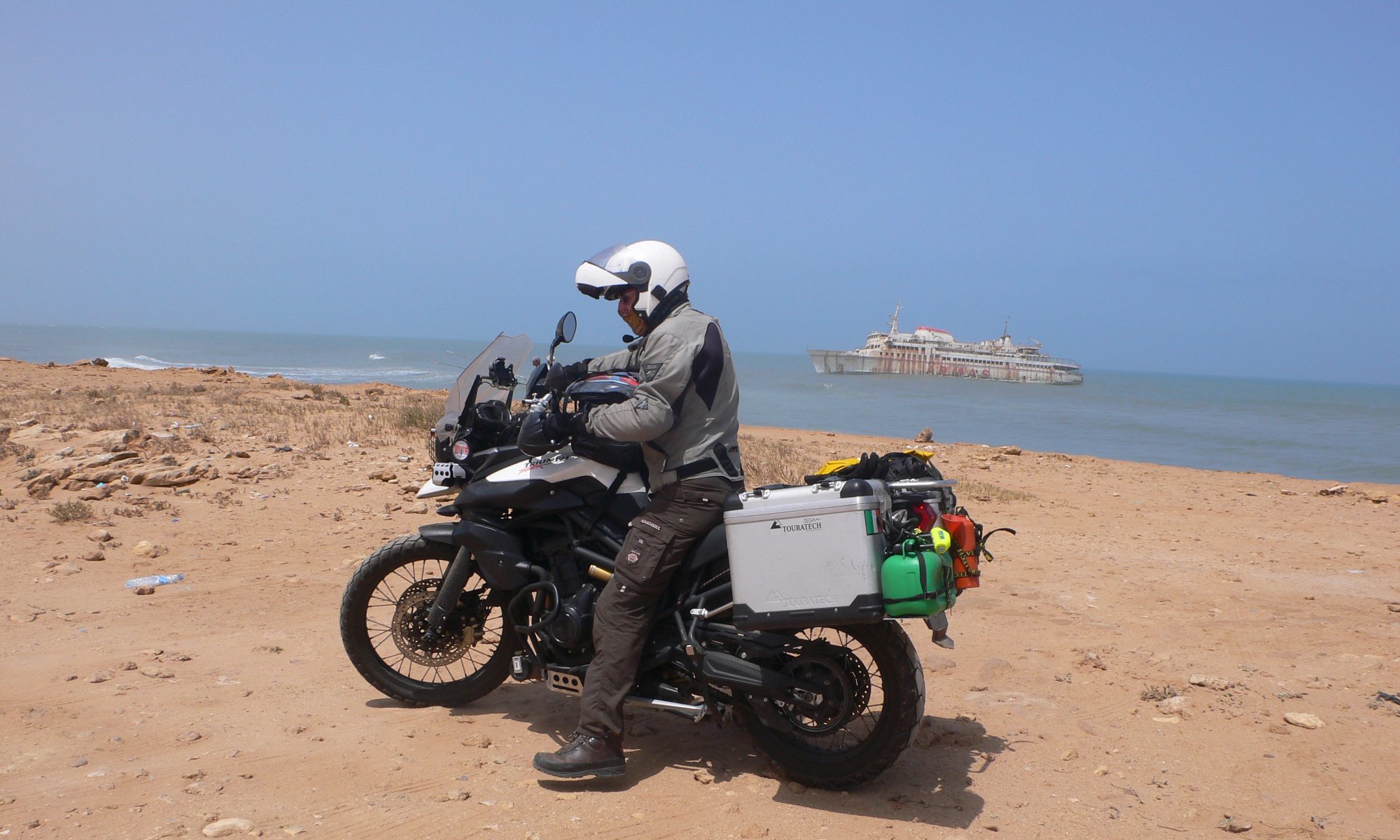
Just up the river and within walking distance is an old graveyard for the paddle steamers. You can still make out the outline of these majestic ships now slowly decaying away.


Went to visit dredge number 4 a National Historic site. This thing is huge, it was transported in pieces from the lower states by rail, steamer and stern wheel river boat, assembled on site. These things where dredging the gravel up from under the permafrost and just above the bedrock, a process called “placer mining”, a technique used to this day. The dredge floated in a self-made pool of water forever inching forward swinging in 180-degree arc. Inside was a revolving drum that sifted the gold from the gravel. It would then dump the gravel out behind it, sealing the hole, inching forward taking its water with it, it didn’t need a constant supply of water. Dredge number 4 ceased working in the early 60s It was no longer viable. It still remains in the same spot as when it stopped.

But the road was calling and it was time to head of down the Klondike Highway to Whitehorse. The highway is mostly paved. The Klondike runs from Skagway, an Alaskan coastal town, to Dawson City in the Yukon.

After Moose Creek, the scenery began to be super. But there was a storm brewing in the mountains and by Minto it started to break.

Pulled into Minto Recreation Park where there was a camping site. Got the tent up and made dinner in the lull in the storm. But then it began in earnest. Was really glad to be dry in my tent. Following morning the sky was blue and the rain was gone. When I arrived in Minto it was afternoon and there was no one in the reception or restaurant. There was a sign saying choose a spot and pay in the morning. The next morning I made my breakfast, a cheese sandwich, packed the bike and decided to buy a coffee, pay and eat my sandwich outside on the banks of the Yukon. Whilst paying got chatting to one of the workers, they were preparing lunch for a couple of bus tours that were coming in later on, everything fresh even the coleslaw. Being a chef, I commented on this, not many places make things from scratch anymore. She gave me some red onion for my sandwich and lo and behold if she didn’t come around a bit later with a huge big plate of fresh made coleslaw, it was gorgeous. Then it was once again time to “giddy up and go”, Whitehorse here we come.

The road from Minto to Whitehorse was fantastic. It ran for the most part along the Yukon. Tracing the route that the old sternwheelers used as they plied their trade along the river. Whole communities lived on the banks. Some of them where wood camps. They stockpiled wood cut into 4-foot lengths.

These camps where situated on strategic places where there was enough depth in the water and the bank was the right height for the stern-wheel steamers to moor up and take on wood. The deckhands would then proceed to load up the wood by hand. Also, these camps would, sometimes, be used as trading posts.

The sternwheelers that navigated the Yukon where flat bottom low draft vessels requiring a minimum of depth. The paddle was located at the rear for a number of reasons, to minimize damage from close encounters with the banks, to facilitate mooring up along the river to take on wood and cargo from settlements and trading posts and most important of all the tremendous amount of water that these stern paddle wheels could move at a time. Navigating the river was an art and a risk. Sand and gravel bars kept moving, depth was subject to change and it was here that the sternwheelers came into their own. If she ran aground the captain would use the force of the water from the paddle wheel to wash the gravel or sand bar away. If that didn’t work he would use the winches and as a last resort the crew would take to the boat and tow it off.

One of the most demanding and hazardous piece was called Five Finger Rapids, taking its name from the 5 rocks crossing the river and the shallow rapids. This posed a problem in the early days of the gold rush for the miners with their heavily overloaded boats, many of whom came to grief and got wet feet, but these posed a bigger problem for the big sternwheelers.

A steel cable was anchored on both ends of the rapids, in between one of the rocks and the bank and the ships winched their way around and along. A real feat of navigation as the overhanging rocky walls of the bank was just centimeters away. Many the paddle steamer that clipped the cliff face with their upper decks.

At Carmacks we part company with the Yukon river and carry onto Takhini hot springs. Stayed two nights on the Takhini campsite, this campsite was a bit more upmarket and included wi-fi, and a 20% discount on admission to the hot springs. I will have to admit I was a bit disappointed in the hot springs.

The water had a very low Sulphur and mineral content. The pool was a man made swimming pool, with a shallow and a deep end. I just couldn’t help comparing it to some of the Hungarian thermal baths and it came up way too short. Still it was kinda neat to soak and laze around in the warm water, it was by no means hot. It did have a warm and a cooler side though. Entrance fee was a whopping 10 dollars and was valid the whole day. They were busy building another bigger complex which should be ready next year.

So, the next day body glowing with a healthy glow it was time to “giddy up and go” to Whitehorse just 20 Km away. 3 km after Takhini the Klondike turns into the Alaska highway for a 17 km drop into Whitehorse and once again in company of the mighty Yukon river. The Klondike will resurface in Whitehorse where it branches off the Alaskan Highway to run to Skagway in Alaska.

Whitehorse the capital of the Yukon, population about 36.000 is a small city on the banks of the Yukon, it’s economical mainstay nowadays being tourism, government and mining. Whitehorse derives it name from the rapids of the Yukon river where the frothing water looked like the manes of white horses.

Whitehorse was founded, when on June the 8th in 1900 the White Pass and Yukon railway was completed on the west side of the river and a small log cabin settlement, on the east side of the river, called Closeleigh moved to the present town site and became Whitehorse. The sparsely populated tent and cabin city boomed and became the terminal for freight being transferred from railway to river steamer for shipment to Dawson city.

For over 50 years Whitehorse continued in this vital role. Another great population surge occurred when the Canadian and the American government finalized an agreement to build the Alaskan highway in 1942, during the 9 month construction the population swelled from 500 to 8000. Building space was at a premium and one clever real estate entrepreneur began building small two and three-story log cabins or “Log skyscrapers” which are still in use today.

Whitehorse is home to many attractions and museums, one of which is the perfectly preserved SS Klondike Sternwheeler on the banks of the Yukon. Spent 3 days in Whitehorse exploring but more important replenishing my supplies.

Travelling these roads mean that you stay in places where there are no shops so you have to carry everything with you. Also, I don’t stop to eat at the restaurants as the menus are pretty basic and all the same, burgers, steaks and fish. So, every evening I cook a fresh meal on the campsites. Stayed in Whitehorse on the Robert service campground and once again had a spot by the Yukon river.

Rested and once again all my supplies replenished it was “Giddy up and go” time. This time the legendary Alaskan Highway to Dawson Creek, mile post zero or the town where it began, awaits our presence. But that is another story and will form the next episode.
Hi Yvonne,
Thanks am enjoying every minute of it, biggest problem is finding the time to post 🙂
Alaska, Canada and America are amazing with a huge diversity of nature.
Have just crossed into Oregon on my way to Seattle, blog and facebook are way behind …. 😉 Facebook page is an open one, you don’t need to register or be a member 🙂 it’s got mostly photos.
Give my love to everyone… Vince